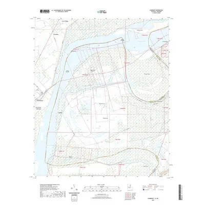
2020 Map of Chamblee
USGS Topo · Published 2020About this map
The Mississippi River creates a dynamic border between Tensas Parish, Louisiana, and Jefferson County, Mississippi, in this 2020 landscape. The river's historical shifts have left behind a complex network of chutes and oxbow-related water bodies, including Rodney Cutoff, Gilliam Chute, and Gum Ridge Chute. These waterway patterns illustrate the ongoing evolution of the state line, which meanders around substantial landforms such as Rodney Island and Buena Vista Island.
Find a feature on this map
49 named features on this map. Tap any name to fly to it.
Don’t see what you’re looking for? This feature index may not catch every label — zoom into the map to look around manually.
Map Details
Editions of this 2020 Chamblee Map
This is the sole edition of this map. No revisions or reprints were ever made.
Other maps of this area

1909 · Delta Bridge
USGS Topo · 1:24,000

1909 · Lake Bruen
USGS Topo · 1:24,000

1921 · Natchez
USGS Topo · 1:48,000

1922 · Natchez
USGS Topo · 1:62,500

1939 · Lorman
USGS Topo · 1:62,500

1939 · Natchez
USGS Topo · 1:62,500

1939 · Locust Ridge
USGS Topo · 1:62,500

1953 · Natchez
USGS Topo · 1:250,000

1956 · Natchez
USGS Topo · 1:250,000

1958 · St. Joseph
USGS Topo · 1:62,500