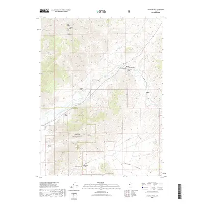
2020 Map of Champlin Peak
USGS Topo · Published 2020About this map
Champlin Peak and the Gilson Mountains dominate the northern landscape of this region where the Sevier River cuts through the high desert. This area is defined by a complex network of water management, including the Leamington Canal, Central Utah Canal, and Macks Ditch, which redirect flow across the arid flats south of the river. The small settlements of Soma and Uisco are located along the river and rail corridor, while the quiet Parley area sits further east.
Find a feature on this map
30 named features on this map. Tap any name to fly to it.
Don’t see what you’re looking for? This feature index may not catch every label — zoom into the map to look around manually.
Map Details
Editions of this 2020 Champlin Peak Map
This is the sole edition of this map. No revisions or reprints were ever made.
Other maps of this area

1885 · Sevier Desert
USGS Topo · 1:250,000

1951 · Oak City
USGS Topo · 1:62,500

1952 · Scipio North
USGS Topo · 1:62,500

1953 · Delta
USGS Topo · 1:250,000

1958 · Delta
USGS Topo · 1:250,000

1962 · Delta
USGS Topo · 1:250,000

1962 · Lynndyl
USGS Topo · 1:62,500

1967 · Champlin Peak
USGS Topo · 1:24,000
1967 · Furner Ridge
USGS Topo · 1:24,000
1967 · Sage Valley
USGS Topo · 1:24,000