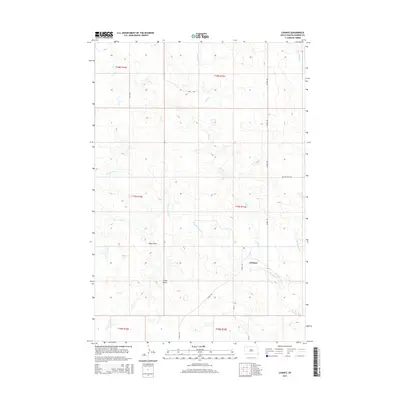
2015 Map of Chance
USGS Topo · Published 2015About this map
Chance serves as the focal point for this expansive section of the High Plains, situated at a junction where Chance Rd meets the local section lines. This 2015 survey reveals a landscape deeply defined by its drainage network, particularly the winding path of Thunder Butte Cr as it traverses the southern half of the quadrangle. The topography is marked by distinct rises like Tailor Butte and the elongated depression of Tailor Draw, which provide significant local relief against the surrounding plains.
Find a feature on this map
18 named features on this map. Tap any name to fly to it.
Don’t see what you’re looking for? This feature index may not catch every label — zoom into the map to look around manually.
Map Details
Editions of this 2015 Chance Map
This is the sole edition of this map. No revisions or reprints were ever made.
Other maps of this area

1954 · Lemmon
USGS Topo · 1:250,000

1957 · Lemmon
USGS Topo · 1:250,000

1983 · Boxcar Buttes
USGS Topo · 1:24,000

1983 · Bison
USGS Topo · 1:24,000

1983 · Sunrise Butte
USGS Topo · 1:24,000

1983 · Meadow
USGS Topo · 1:24,000

1983 · Coal Springs SW
USGS Topo · 1:24,000

1983 · Owen Lake
USGS Topo · 1:24,000

1983 · Coal Springs NW
USGS Topo · 1:24,000
1983 · Chance
USGS Topo · 1:24,000