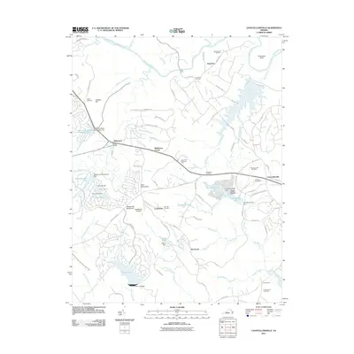
2011 Map of Chancellorsville
USGS Topo · Published 2011About this map
The Chancellorsville Battlefield and its commemorative landmarks anchor this landscape, reflecting a region deeply defined by its military history. In the early 21st century, the area shows a complex layering of legacy and modern development. Residential communities like Wilderness Park Estates and large water features such as Lake of the Woods Number Two and Fawn Lake Dam occupy the terrain once moved through by soldiers.
Find a feature on this map
108 named features on this map. Tap any name to fly to it.
Don’t see what you’re looking for? This feature index may not catch every label — zoom into the map to look around manually.
Map Details
Editions of this 2011 Chancellorsville Map
This is the sole edition of this map. No revisions or reprints were ever made.
Other maps of this area

1887 · Spottsylvania
USGS Topo · 1:125,000

1892 · Spottsylvania
USGS Topo · 1:125,000

1942 · Belmont
USGS Topo · 1:31,680

1942 · Spotsylania
USGS Topo · 1:31,680

1942 · Brokenburg
USGS Topo · 1:31,680

1943 · Germanna Bridge
USGS Topo · 1:24,000

1943 · Chancellorsville
USGS Topo · 1:24,000

1943 · Salem Church
USGS Topo · 1:24,000

1943 · Mine Run
USGS Topo · 1:24,000
1944 · Mine Run
USGS Topo · 1:31,680