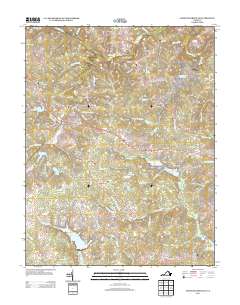
2013 Map of Chancellorsville
USGS Topo · Published 2013About this map
The Chancellorsville Battlefield and its commemorative landmarks anchor this landscape, reflecting the heavy Civil War history that defines this portion of Virginia. Commemorative sites like the Hays Monument and Wadsworth Monument stand near Hamiltons Thicket, marking specific points of the 1863 conflict. The terrain is deeply carved by the Rapidan River to the north and numerous runs and branches, including Hunting Run and Keatons Run.
Find a feature on this map
141 named features on this map. Tap any name to fly to it.
Don’t see what you’re looking for? This feature index may not catch every label — zoom into the map to look around manually.
Map Details
Editions of this 2013 Chancellorsville Map
This is the sole edition of this map. No revisions or reprints were ever made.
Other maps of this area

1887 · Spottsylvania
USGS Topo · 1:125,000

1892 · Spottsylvania
USGS Topo · 1:125,000

1942 · Belmont
USGS Topo · 1:31,680

1942 · Spotsylania
USGS Topo · 1:31,680

1942 · Brokenburg
USGS Topo · 1:31,680

1943 · Germanna Bridge
USGS Topo · 1:24,000

1943 · Chancellorsville
USGS Topo · 1:24,000

1943 · Salem Church
USGS Topo · 1:24,000

1943 · Mine Run
USGS Topo · 1:24,000
1944 · Mine Run
USGS Topo · 1:31,680