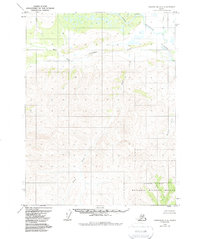
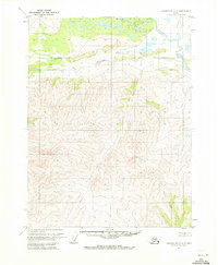
1970 Map of Chandalar A-4
USGS Topo · Published 1988About this map
North Fork Chandalar River and the West Fork Chandalar River converge within this remote northern landscape, defining a region of dramatic topographic relief and complex drainage. A solitary Cabin sits near the eastern edge of the quadrangle, marking a rare point of human habitation along the riverbanks. The southern portion of the map transitions into the Yukon Flats, a broad lowland area protected within the Yukon Flats National Wildlife Refuge. Numerous unnamed streams and identified tributaries like Monarch Creek and Slate Creek cut through the steep elevations. An established Trail provides a corridor through the central valley, following the natural contours between the high ridges and the river system.
Find a feature on this map
10 named features on this map. Tap any name to fly to it.
Don’t see what you’re looking for? This feature index may not catch every label — zoom into the map to look around manually.
Map Details
Editions of this 1970 Chandalar A-4 Map
2 editions found
Other maps of this area

1951 · Chandalar
USGS Topo · 1:250,000

1951 · Beaver
USGS Topo · 1:250,000

1956 · Chandalar
USGS Topo · 1:250,000

1956 · Beaver
USGS Topo · 1:250,000

1964 · Chandalar
USGS Topo · 1:250,000

1964 · Beaver
USGS Topo · 1:250,000
1970 · Beaver D-5
USGS Topo · 1:63,360
1970 · Beaver D-4
USGS Topo · 1:63,360
1970 · Chandalar A-5
USGS Topo · 1:63,360
1970 · Chandalar A-4
USGS Topo · 1:63,360