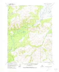
1970 Map of Chandalar A-6
USGS Topo · Published 1973About this map
The South Fork Koyukuk River winds through this subarctic interior landscape, where the vast South Fork Flats meet the rising topography of Eagle Cliff. This 1970 survey documents a landscape defined by seasonal transit and remote outposts, centered around a Landing Strip and isolated Cabins along Myrtle Creek. The presence of a Winter Trail stretching across the northern section highlights the era's reliance on cold-weather routes for movement through the Yukon-Koyukuk region.
Find a feature on this map
16 named features on this map. Tap any name to fly to it.
Don’t see what you’re looking for? This feature index may not catch every label — zoom into the map to look around manually.
Map Details
Editions of this 1970 Chandalar A-6 Map
2 editions found
Other maps of this area

1951 · Bettles
USGS Topo · 1:250,000

1951 · Chandalar
USGS Topo · 1:250,000

1951 · Beaver
USGS Topo · 1:250,000

1951 · Wiseman
USGS Topo · 1:250,000

1956 · Chandalar
USGS Topo · 1:250,000

1956 · Bettles
USGS Topo · 1:250,000

1956 · Wiseman
USGS Topo · 1:250,000

1956 · Beaver
USGS Topo · 1:250,000

1964 · Wiseman
USGS Topo · 1:250,000

1964 · Chandalar
USGS Topo · 1:250,000