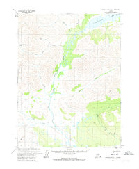
1971 Map of Chandalar B-4
USGS Topo · Published 1973About this map
Chandalar Lake anchors the northeast corner of this Arctic landscape, where the waters of Rosalie Creek and Indian Creek gather before feeding the drainage systems to the south. The terrain is defined by the braided path of the Chandalar River and its major tributary, the North Fork Chandalar River. This 1971 survey reveals a remote interior where human presence is marked by isolated Cabins and a primitive Winter Trail that follows the valley of Big Creek. A single Gold deposit near Goldbug Creek suggests the area's mineral prospects, while a remote Landing Strip near the lake serves as the primary connection to the outside world. The map also records family-named or descriptive landmarks like Woodland Echo Pass and the distinctive East Buttons, illustrating the early naming conventions of surveyors and bush pilots in the Brooks Range foothills.
Find a feature on this map
20 named features on this map. Tap any name to fly to it.
Don’t see what you’re looking for? This feature index may not catch every label — zoom into the map to look around manually.
Map Details
Editions of this 1971 Chandalar B-4 Map
This is the sole edition of this map. No revisions or reprints were ever made.
Other maps of this area

1951 · Chandalar
USGS Topo · 1:250,000

1956 · Chandalar
USGS Topo · 1:250,000

1964 · Chandalar
USGS Topo · 1:250,000
1970 · Chandalar A-5
USGS Topo · 1:63,360
1970 · Chandalar A-4
USGS Topo · 1:63,360

1971 · Chandalar B-5
USGS Topo · 1:63,360

1971 · Chandalar C-5
USGS Topo · 1:63,360
1971 · Chandalar C-4
USGS Topo · 1:63,360
1990 · Chandalar B-3
USGS Topo · 1:63,360
1990 · Chandalar A-3
USGS Topo · 1:63,360