
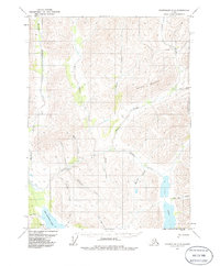
1971 Map of Chandalar C-5
USGS Topo · Published 1973About this map
Mathews River and Bettles River dominate this interior Alaskan landscape, which was mapped from 1970 aerial photography. The region's transport network relies heavily on nature and isolation, evidenced by a remote Landing Strip and scattered Cabin sites along the riverbanks. The drainage pattern is complex, with tributaries like Big Spruce Creek, Sheep Creek, and Eightmile Creek carving through the terrain around Horace Mountain. To the south, Twin Lakes and Big Lake provide significant water features in a region defined by its waterway-connected subsistence architecture. The presence of several Trails suggests established routes between drainage basins, while place names like Last Chance Creek and Big Jim Creek hint at the personal histories and prospecting efforts of the early 20th century.
Find a feature on this map
23 named features on this map. Tap any name to fly to it.
Don’t see what you’re looking for? This feature index may not catch every label — zoom into the map to look around manually.
Map Details
Editions of this 1971 Chandalar C-5 Map
2 editions found
Other maps of this area

1951 · Chandalar
USGS Topo · 1:250,000

1956 · Chandalar
USGS Topo · 1:250,000

1964 · Chandalar
USGS Topo · 1:250,000
1971 · Chandalar D-6
USGS Topo · 1:63,360
1971 · Chandalar D-5
USGS Topo · 1:63,360

1971 · Chandalar B-5
USGS Topo · 1:63,360
1971 · Chandalar C-6
USGS Topo · 1:63,360
1971 · Chandalar C-4
USGS Topo · 1:63,360
1971 · Chandalar B-4
USGS Topo · 1:63,360
1971 · Chandalar D-4
USGS Topo · 1:63,360