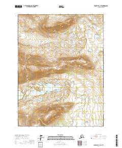
2017 Map of Chandalar C-1 SW
USGS Topo · Published 2017About this map
Vunittsieh Lakes lie at the heart of this northern interior landscape, situated between the surveyed boundaries of t32n r1e and t31n r2e. The drainage patterns in this portion of the Yukon-Koyukuk Census Area are defined by the winding paths of Glacier Cr in the north and Chekhechunnjik Cr to the southeast. Near the southwestern edge, Ackerman Lake serves as a prominent landmark in a region characterized by high-elevation contours and isolated water bodies. The lack of roads or established settlements emphasizes the wilderness character of the terrain, where hydrological features like these lakes and creeks are the primary points of orientation for navigation and land use.
Find a feature on this map
8 named features on this map. Tap any name to fly to it.
Don’t see what you’re looking for? This feature index may not catch every label — zoom into the map to look around manually.
Map Details
Editions of this 2017 Chandalar C-1 SW Map
This is the sole edition of this map. No revisions or reprints were ever made.
Other maps of this area

1951 · Chandalar
USGS Topo · 1:250,000

1956 · Chandalar
USGS Topo · 1:250,000

1964 · Chandalar
USGS Topo · 1:250,000

1990 · Chandalar C-2
USGS Topo · 1:63,360
1990 · Chandalar B-1
USGS Topo · 1:63,360
1990 · Chandalar B-2
USGS Topo · 1:63,360
1990 · Chandalar C-1
USGS Topo · 1:63,360
2017 · Chandalar C-2 NE
USGS Topo · 1:25,000
2017 · Chandalar C-1 NW
USGS Topo · 1:25,000
2017 · Chandalar B-2 NE
USGS Topo · 1:25,000