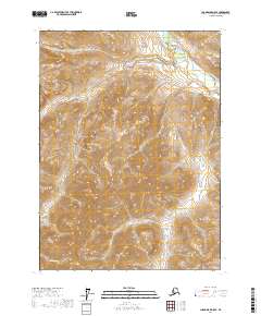
2017 Map of Chandalar D-5 SE
USGS Topo · Published 2017About this map
The North Fork Chandalar River cuts through the northeast corner of this remote Alaskan interior landscape, serving as a primary waterway for this reach of the Yukon-Koyukuk region. In the years leading up to this 2017 survey, the terrain is defined by its dramatic relief and drainage patterns, with Quartz Creek and its smaller tributary Quartz Cr dissecting the high ridges of the central and northern sections. To the south, the headwaters of Robert Cr and Big Spruce Cr flow through deep valleys, illustrating the complex hydrology that governs movement in this roadless wilderness. The lack of built infrastructure or settlements on this sheet highlights the pristine nature of these highlands, where the topography itself dictated the paths of any who ventured through the Chandalar River's drainage basins.
Find a feature on this map
11 named features on this map. Tap any name to fly to it.
Don’t see what you’re looking for? This feature index may not catch every label — zoom into the map to look around manually.
Map Details
Editions of this 2017 Chandalar D-5 SE Map
This is the sole edition of this map. No revisions or reprints were ever made.
Other maps of this area

1951 · Chandalar
USGS Topo · 1:250,000

1956 · Chandalar
USGS Topo · 1:250,000

1964 · Chandalar
USGS Topo · 1:250,000
1971 · Chandalar D-5
USGS Topo · 1:63,360

1971 · Chandalar C-5
USGS Topo · 1:63,360
1971 · Chandalar C-4
USGS Topo · 1:63,360
1971 · Chandalar D-4
USGS Topo · 1:63,360
2017 · Chandalar C-4 NW
USGS Topo · 1:25,000
2017 · Chandalar D-4 SW
USGS Topo · 1:25,000
2017 · Chandalar C-5 NE
USGS Topo · 1:25,000