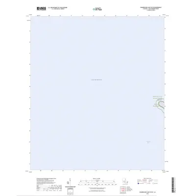
2024 Map of Chandeleur Light OE W
USGS Topo · Published 2024About this map
Breton National Wildlife Refuge and the surrounding coastal waters of Saint Bernard Parish define this maritime environment. The survey focuses on the shifting edge of the barrier island chain, where Hewes Point marks a critical landform within the protected Breton Wilderness. This area, situated between the open Gulf of Mexico and the more sheltered Chandeleur Sound, is a landscape defined entirely by shoreline dynamics and ecological preservation. The lack of terrestrial infrastructure emphasizes the region's role as a sanctuary, far removed from the developed Louisiana mainland.
Find a feature on this map
5 named features on this map. Tap any name to fly to it.
Don’t see what you’re looking for? This feature index may not catch every label — zoom into the map to look around manually.
Map Details
Editions of this 2024 Chandeleur Light OE W Map
This is the sole edition of this map. No revisions or reprints were ever made.
Other maps of this area

1893 · Cat Island
USGS Topo · 1:62,500

1893 · Chandeleur
USGS Topo · 1:62,500

1950 · Dog Keys Pass
USGS Topo · 1:24,000

1950 · Ship Island
USGS Topo · 1:24,000

1951 · North Islands
USGS Topo · 1:24,000

1951 · Cat Island
USGS Topo · 1:24,000

1951 · Chandeleur Light
USGS Topo · 1:24,000

1953 · Mobile
USGS Topo · 1:250,000

1957 · Mobile
USGS Topo · 1:250,000

1957 · Breton Sound
USGS Topo · 1:250,000