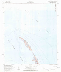
1951 Map of Chandeleur Light
USGS Topo · Published 1958About this map
Chandeleur Light stands as the primary navigational landmark on this remote stretch of the Chandeleur Islands in St. Bernard Parish. This coastal survey reflects the shifting sands of the Louisiana barrier island chain in the early 1950s, documenting the narrow ribbon of land that separates the open Gulf of Mexico from the calmer waters of Chandeleur Sound. Much of the southern portion of this archipelago is protected within the Breton National Wildlife Refuge, one of the earliest established wildlife sanctuaries in the nation. The map provides a precise record of the shoreline and depth curves before decades of erosion and storm surge significantly altered these low-lying landforms. Notably, the cartography omits the state boundary between Mississippi and Louisiana due to insufficient data at the time of the survey, highlighting the complex and changing nature of this maritime environment.
Find a feature on this map
7 named features on this map. Tap any name to fly to it.
Don’t see what you’re looking for? This feature index may not catch every label — zoom into the map to look around manually.
Map Details
Editions of this 1951 Chandeleur Light Map
2 editions found
Other maps of this area

1950 · Dog Keys Pass
USGS Topo · 1:24,000

1950 · Ship Island
USGS Topo · 1:24,000

1951 · North Islands
USGS Topo · 1:24,000

1951 · Chandeleur Light
USGS Topo · 1:24,000

1953 · Mobile
USGS Topo · 1:250,000

1957 · Mobile
USGS Topo · 1:250,000

1957 · Breton Sound
USGS Topo · 1:250,000

1960 · Mobile
USGS Topo · 1:250,000

1961 · Breton Sound
USGS Topo · 1:250,000

1963 · Mobile
USGS Topo · 1:250,000