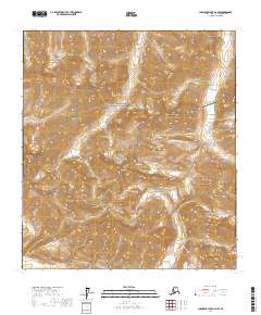
2017 Map of Chandler Lake A-2 NW
USGS Topo · Published 2017About this map
The Brooks Range dominates this high-latitude survey, which covers a remote portion of Northern Alaska within the Gates of the Arctic National Park and Gates of the Arctic National Preserve. The landscape is defined by extreme elevation changes and drainage patterns that carve through the mountainous terrain. Notable peaks include Alapah Mtn in the north and Fan Mtn further south, serving as prominent landmarks in an area devoid of roads or permanent human settlements. The hydrology of the quadrangle is equally significant, featuring the winding headwaters of Alapah Cr and Kayak Cr, alongside the curiously named Fake Creek. This 2017 edition provides a precise view of the topography and protected wilderness boundaries of the North Slope at the start of the 21st century.
Find a feature on this map
12 named features on this map. Tap any name to fly to it.
Don’t see what you’re looking for? This feature index may not catch every label — zoom into the map to look around manually.
Map Details
Editions of this 2017 Chandler Lake A-2 NW Map
This is the sole edition of this map. No revisions or reprints were ever made.
Other maps of this area

1951 · Chandler Lake
USGS Topo · 1:250,000

1956 · Chandler Lake
USGS Topo · 1:250,000

1964 · Chandler Lake
USGS Topo · 1:250,000
1971 · Chandler Lake A-2
USGS Topo · 1:63,360

1971 · Chandler Lake A-3
USGS Topo · 1:63,360
1971 · Chandler Lake B-2
USGS Topo · 1:63,360
1987 · Chandler Lake B-3
USGS Topo · 1:63,360
2016 · Chandler Lake A-3 NE
USGS Topo · 1:25,000
2016 · Chandler Lake B-3 SE
USGS Topo · 1:25,000
2016 · Chandler Lake A-3 SE
USGS Topo · 1:25,000