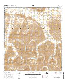
2016 Map of Chandler Lake A-3 SE
USGS Topo · Published 2016About this map
Gates of the Arctic National Park encompasses the majority of this landscape, where high-altitude ridges and glacial valleys define the northern interior of Alaska. The Anaktuvuk River flows through the northern reaches of the quadrangle, carving a path through the towering Endicott Mountains. A critical geographic boundary is marked by the Continental Divide, which traverses the southern portion of the map, separating the drainage basins of the Arctic and Pacific oceans. This 2016 survey illustrates the extreme isolation and vertical relief of the Brooks Range, showing a terrain shaped by massive elevation changes and the sparse network of mountain streams. The lack of human infrastructure or established settlements reflects the strictly preserved nature of this wilderness area at the start of the twenty-first century.
Find a feature on this map
10 named features on this map. Tap any name to fly to it.
Don’t see what you’re looking for? This feature index may not catch every label — zoom into the map to look around manually.
Map Details
Editions of this 2016 Chandler Lake A-3 SE Map
This is the sole edition of this map. No revisions or reprints were ever made.
Other maps of this area

1951 · Chandler Lake
USGS Topo · 1:250,000

1951 · Wiseman
USGS Topo · 1:250,000

1956 · Wiseman
USGS Topo · 1:250,000

1956 · Chandler Lake
USGS Topo · 1:250,000

1964 · Wiseman
USGS Topo · 1:250,000

1964 · Chandler Lake
USGS Topo · 1:250,000
1971 · Chandler Lake A-2
USGS Topo · 1:63,360

1971 · Chandler Lake A-3
USGS Topo · 1:63,360
1971 · Wiseman D-4
USGS Topo · 1:63,360
1971 · Wiseman D-3
USGS Topo · 1:63,360