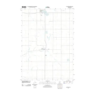
2010 Map of Chandler
USGS Topo · Published 2010About this map
The agricultural landscape of Murray County is defined by the settlements of Chandler and Lake Wilson, which anchor this 2010 survey. The township's grid of section roads, including Valley Rd and County Hwy 4, connects isolated farmsteads with civic centers like the Chandler Post Office and Lake Wilson Post Office. The terrain is shaped by a complex hydrology of natural waterways and early 20th-century drainage engineering, seen in the winding path of Chanarambie Creek and the straight line of Judicial Ditch Number Fourteen. Genealogists will find several significant burial sites, including Hillside Cemetery overlooking the lake and Trinity Cemetery on the eastern edge of town. Smaller water bodies like Moon Lake and the upper reaches of Champepadan Creek further characterize this prairie region during a period of steady rural land use.
Find a feature on this map
33 named features on this map. Tap any name to fly to it.
Don’t see what you’re looking for? This feature index may not catch every label — zoom into the map to look around manually.
Map Details
Editions of this 2010 Chandler Map
This is the sole edition of this map. No revisions or reprints were ever made.
Other maps of this area

1953 · Watertown
USGS Topo · 1:250,000

1953 · New Ulm
USGS Topo · 1:250,000

1954 · Fairmont
USGS Topo · 1:250,000

1955 · Sioux Falls
USGS Topo · 1:250,000

1957 · New Ulm
USGS Topo · 1:250,000

1958 · New Ulm
USGS Topo · 1:250,000

1958 · Sioux Falls
USGS Topo · 1:250,000

1958 · Fairmont
USGS Topo · 1:250,000

1958 · Watertown
USGS Topo · 1:250,000

1967 · New Ulm
USGS Topo · 1:250,000