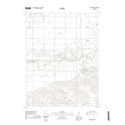
2021 Map of Chandlerville
USGS Topo · Published 2021About this map
The Sangamon River meanders through a complex valley floor here, creating a dense network of wetlands and backwaters along the Mason and Cass county line. This environment is defined by distinctive water features such as Johnson Slough, Calomel Lake, and Theivaught Slough, which flank the river's main channel. The settlement of Chandlerville occupies the southern bluffs, overlooking the river valley from a position of higher elevation, where the terrain shifts toward the dissected uplands of Maximillian Hollow.
Find a feature on this map
67 named features on this map. Tap any name to fly to it.
Don’t see what you’re looking for? This feature index may not catch every label — zoom into the map to look around manually.
Map Details
Editions of this 2021 Chandlerville Map
This is the sole edition of this map. No revisions or reprints were ever made.
Other maps of this area

1926 · Beardstown
USGS Topo · 1:62,500

1929 · Arenzville
USGS Topo · 1:62,500

1930 · Chandlerville
USGS Topo · 1:62,500

1932 · Arenzville
USGS Topo · 1:62,500

1932 · Chandlerville
USGS Topo · 1:62,500

1932 · Virginia
USGS Topo · 1:62,500

1936 · Virginia
USGS Topo · 1:62,500

1944 · Beardstown
USGS Topo · 1:62,500

1948 · Quincy
USGS Topo · 1:250,000

1956 · Quincy
USGS Topo · 1:250,000