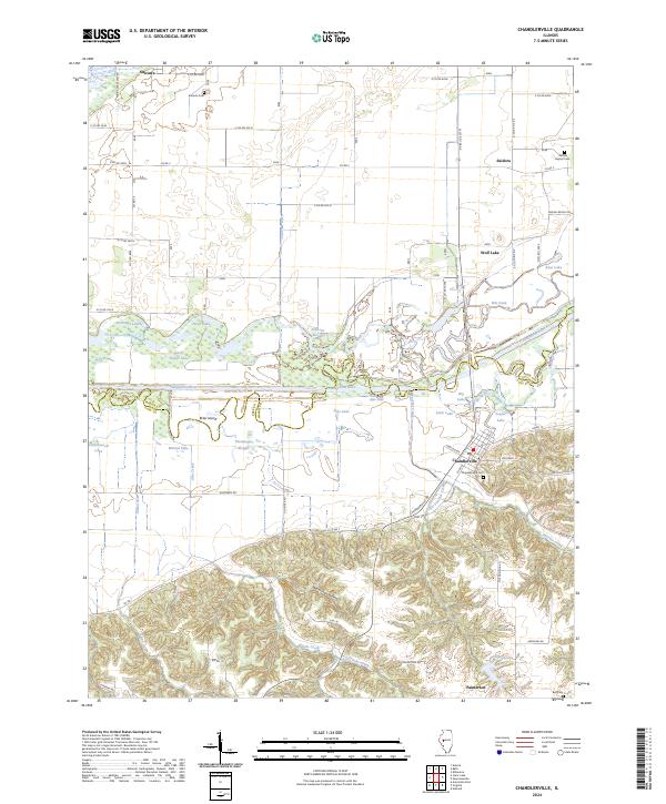
2024 Map of Chandlerville
USGS Topo · Published 2024About this map
The Sangamon River carves a broad valley through this central Illinois landscape, forming the natural boundary between Mason and Cass Counties. The river's historical path is traced by a complex network of backwaters and sloughs, including Theivaught Slough, Johnson Slough, and numerous oxbow lakes such as Big Lake and Wolf Lake. On the southern terrace of this flood plain, the village of Chandlerville serves as the primary settlement, situated near the confluence of Little Panther Creek.
Find a feature on this map
70 named features on this map. Tap any name to fly to it.
Don’t see what you’re looking for? This feature index may not catch every label — zoom into the map to look around manually.
Map Details
Editions of this 2024 Chandlerville Map
This is the sole edition of this map. No revisions or reprints were ever made.
Other maps of this area

1926 · Beardstown
USGS Topo · 1:62,500

1929 · Arenzville
USGS Topo · 1:62,500

1930 · Chandlerville
USGS Topo · 1:62,500

1932 · Arenzville
USGS Topo · 1:62,500

1932 · Chandlerville
USGS Topo · 1:62,500

1932 · Virginia
USGS Topo · 1:62,500

1936 · Virginia
USGS Topo · 1:62,500

1944 · Beardstown
USGS Topo · 1:62,500

1948 · Quincy
USGS Topo · 1:250,000

1956 · Quincy
USGS Topo · 1:250,000