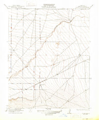
1922 Map of Chaney Ranch
USGS Topo · Published 1922About this map
Chaney Ranch stands as the primary namesake landmark in this corner of Fresno County during the early 1920s, reflecting the era's expansive agricultural operations in the San Joaquin Valley. The landscape is defined by the winding course of Panoche Creek, which cuts through the terrain from the southwest toward the northeast. This 1920 survey reveals a sparse network of roads and section lines, emphasizing the transition from open range to organized land tracts. The presence of numerous bench marks across the sheet indicates the rigorous surveying efforts of the era, while the proximity of the watercourse suggests its vital role in the regional geography and ranching life of the period.
Find a feature on this map
2 named features on this map. Tap any name to fly to it.
Don’t see what you’re looking for? This feature index may not catch every label — zoom into the map to look around manually.
Map Details
Editions of this 1922 Chaney Ranch Map
2 editions found
Other maps of this area

1913 · Panoche
USGS Topo · 1:125,000

1921 · Tierra Loma School
USGS Topo · 1:31,680

1922 · Tufts Ranch
USGS Topo · 1:31,680

1922 · Chaney Ranch
USGS Topo · 1:31,680

1923 · Levis
USGS Topo · 1:31,680

1923 · Wisdom Well
USGS Topo · 1:31,680

1923 · Firebaugh
USGS Topo · 1:31,680

1923 · Tierra Loma School
USGS Topo · 1:31,680

1923 · Little Panoche
USGS Topo · 1:31,680

1923 · Monocline Ridge
USGS Topo · 1:31,680