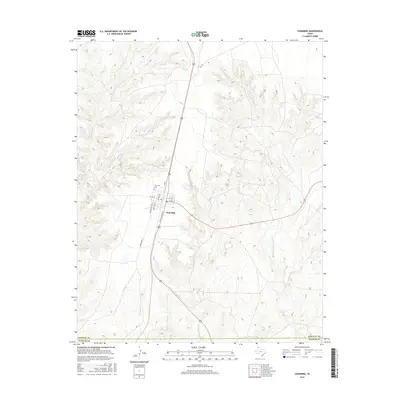
2016 Map of Channing
USGS Topo · Published 2016About this map
Channing serves as the primary hub of this High Plains landscape, situated at the crossroads of the region's transport network. The town's grid is anchored by Main St and Rock Island Ave, a name that points to the area's historical reliance on the railroad for cattle shipping and commerce. Just to the northwest lies the Channing Cem, a site of significant genealogical value for Hartley County families. Beyond the town limits, the terrain is defined by a dendritic drainage system. Numerous watercourses, including Los Redos Cr and the various branches of the Cheyenne Creek system, such as Middle Cheyenne Cr and the W Fork E Cheyenne Cr, carve through the plains. The landscape's transition from the flat tableland to these creek beds is highlighted by numerous contour lines, reflecting the erosion patterns typical of this part of the Texas Panhandle.
Find a feature on this map
19 named features on this map. Tap any name to fly to it.
Don’t see what you’re looking for? This feature index may not catch every label — zoom into the map to look around manually.
Map Details
Editions of this 2016 Channing Map
This is the sole edition of this map. No revisions or reprints were ever made.
Other maps of this area
1954 · Tucumcari
USGS Topo · 1:250,000
1958 · Tucumcari
USGS Topo · 1:250,000
1963 · Hartley SE
USGS Topo · 1:24,000
1963 · Bird Ranch Store
USGS Topo · 1:24,000
1971 · Bivins Channing Ranch
USGS Topo · 1:24,000
1971 · Channing NW
USGS Topo · 1:24,000
1971 · Boys Ranch West
USGS Topo · 1:24,000
1971 · Boys Ranch East
USGS Topo · 1:24,000
1971 · Torrey House
USGS Topo · 1:24,000
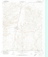
1971 · Channing
USGS Topo · 1:24,000