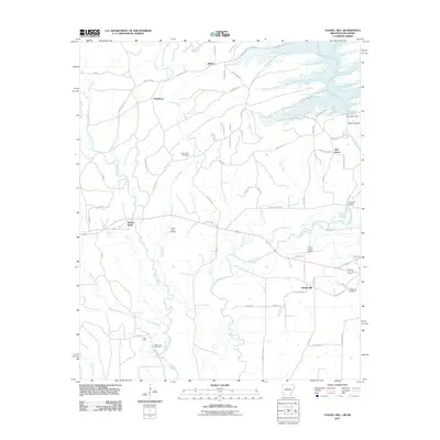
2011 Map of Chapel Hill
USGS Topo · Published 2011About this map
The Oklahoma and Arkansas border defines this landscape, where State Line Rd and State Line Loop trace the boundary between McCurtain and Sevier counties. The terrain is dominated by the winding course of the Rolling Fork and its tributaries, including Cane Creek and Rock Creek. Small communities and family settlements are dispersed throughout the region, ranging from Kellum and Cheatham in the north to the curiously named Ultima Thule and Chapel Hill further south. Genealogists will find significant local history preserved in the various burial grounds scattered across the countryside, such as the Ultima Thule Cemetery, Chapel Hill Cemetery, and West Line Cemetery. To the northeast, the Rolling Fork is impacted by the De Queen Dam, creating a distinct shift from the natural riverbed to the managed waters of Glen Canyon.
Find a feature on this map
76 named features on this map. Tap any name to fly to it.
Don’t see what you’re looking for? This feature index may not catch every label — zoom into the map to look around manually.
Map Details
Editions of this 2011 Chapel Hill Map
This is the sole edition of this map. No revisions or reprints were ever made.
Other maps of this area

1902 · Lukfata
USGS Topo · 1:125,000

1913 · De Queen
USGS Topo · 1:125,000

1950 · Mcalester
USGS Topo · 1:250,000

1950 · Goodwater
USGS Topo · 1:24,000

1951 · Goodwater
USGS Topo · 1:24,000

1951 · Cerrogordo
USGS Topo · 1:24,000

1951 · Horatio
USGS Topo · 1:24,000

1953 · Texarkana
USGS Topo · 1:250,000

1956 · Texarkana
USGS Topo · 1:250,000

1959 · Broken Bow
USGS Topo · 1:62,500