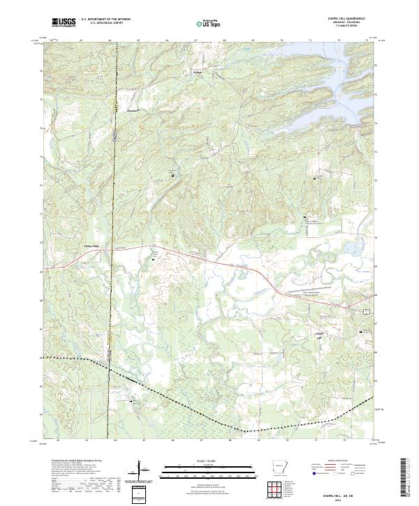
2024 Map of Chapel Hill
USGS Topo · Published 2024About this map
The Oklahoma Arkansas state line bisects this region where the rolling waters of the Rolling Fork and Rock Creek define the landscape. Small settlements and rural hubs like Ultima Thule and Chapel Hill anchor the local geography, connected by a network of county roads and the arterial Collin Raye. The map reveals a high density of sites for genealogical research, featuring numerous burial grounds including the Ultima Thule Cem, Oak Grove Cem, and the uniquely named All Saints of America Orthodox Church Cem.
Find a feature on this map
62 named features on this map. Tap any name to fly to it.
Don’t see what you’re looking for? This feature index may not catch every label — zoom into the map to look around manually.
Map Details
Editions of this 2024 Chapel Hill Map
This is the sole edition of this map. No revisions or reprints were ever made.
Other maps of this area

1902 · Lukfata
USGS Topo · 1:125,000

1913 · De Queen
USGS Topo · 1:125,000

1950 · Mcalester
USGS Topo · 1:250,000

1950 · Goodwater
USGS Topo · 1:24,000

1951 · Goodwater
USGS Topo · 1:24,000

1951 · Cerrogordo
USGS Topo · 1:24,000

1951 · Horatio
USGS Topo · 1:24,000

1953 · Texarkana
USGS Topo · 1:250,000

1956 · Texarkana
USGS Topo · 1:250,000

1959 · Broken Bow
USGS Topo · 1:62,500