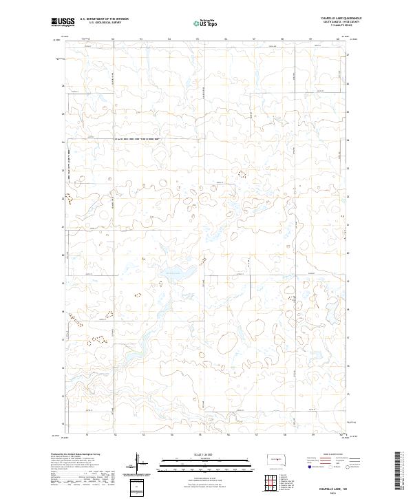
2021 Map of Chapelle Lake
USGS Topo · Published 2021About this map
Marshy Lake and the meandering path of Chapelle Cr define this stretch of Hyde County, South Dakota. This interior prairie landscape is organized by a rigorous grid of section lines and gravel roads, including the long north-south corridor of Holabird Grade and Co Rd 961. The terrain is characterized by numerous small depressions and seasonal wetlands typical of the Missouri Plateau, where the drainage of Chapelle Cr serves as the primary hydrological feature. While no large townships are present on this specific quadrangle, the network of local routes like 199th St and 207th St provides the essential infrastructure for the region's agricultural operations. The map provides a detailed look at the land division and water resources of the South Dakota plains during the early twenty-first century.
Find a feature on this map
20 named features on this map. Tap any name to fly to it.
Don’t see what you’re looking for? This feature index may not catch every label — zoom into the map to look around manually.
Map Details
Editions of this 2021 Chapelle Lake Map
This is the sole edition of this map. No revisions or reprints were ever made.
Other maps of this area

1950 · Highmore
USGS Topo · 1:24,000

1953 · Huron
USGS Topo · 1:250,000

1954 · Huron
USGS Topo · 1:250,000

1968 · Harrold
USGS Topo · 1:24,000

1968 · Holabird
USGS Topo · 1:24,000

1973 · Chapelle Lake SE
USGS Topo · 1:24,000

1973 · Chapelle Lake SW
USGS Topo · 1:24,000

1973 · Chapelle Lake
USGS Topo · 1:24,000

1973 · Macs Corner
USGS Topo · 1:24,000
1973 · Macs Corner NW
USGS Topo · 1:24,000