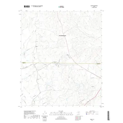
2019 Map of Chapin
USGS Topo · Published 2019About this map
Baker and Chapin anchor this 2019 survey of the undulating ranch lands and residential developments straddling the Parker Co and Hood Co line. The landscape is defined by an intricate network of waterways, including Long Cr and Rucker Cr, which carve through the terrain south of Weatherford. For those tracing local heritage, the map identifies significant land markers like Baker Cem and Long Creek Cem, alongside the natural landmark of Parkinson Springs. This modern topography shows the transition of traditional cattle country into a residential patchwork, evidenced by a dense grid of newer roads such as Highland Lakes Dr and Edinburgh Ln contrasting with older routes like Baker Rd and the Old Granbury Rd.
Find a feature on this map
45 named features on this map. Tap any name to fly to it.
Don’t see what you’re looking for? This feature index may not catch every label — zoom into the map to look around manually.
Map Details
Editions of this 2019 Chapin Map
This is the sole edition of this map. No revisions or reprints were ever made.
Other maps of this area

1889 · Granbury
USGS Topo · 1:125,000

1891 · Weatherford
USGS Topo · 1:125,000

1893 · Weatherford
USGS Topo · 1:125,000

1923 · Granbury 2-a
USGS Topo · 1:48,000

1923 · Granbury 1-b
USGS Topo · 1:48,000

1924 · Weatherford 3-d
USGS Topo · 1:48,000

1928 · Godley
USGS Topo · 1:62,500

1931 · Dennis
USGS Topo · 1:62,500

1931 · Tolar
USGS Topo · 1:62,500

1954 · Dallas
USGS Topo · 1:250,000