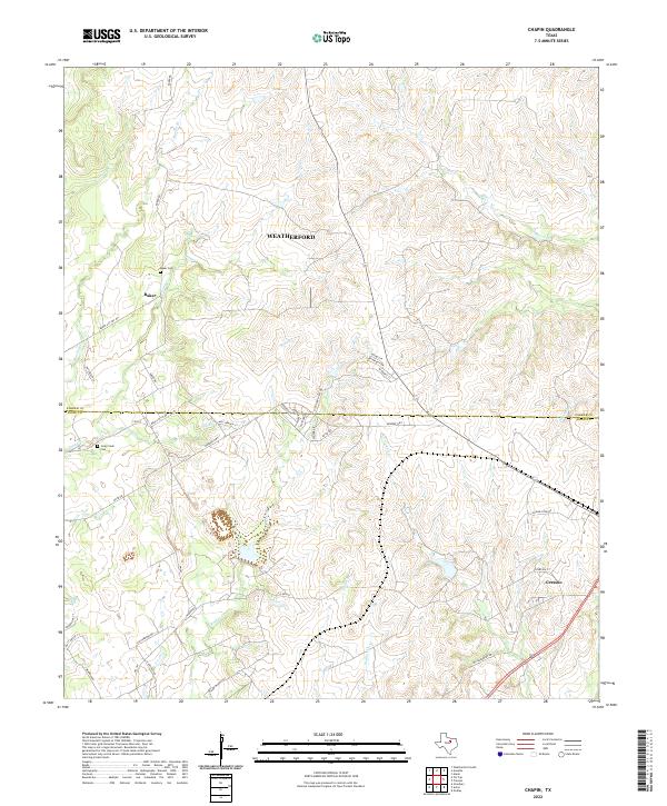
2022 Map of Chapin
USGS Topo · Published 2022About this map
The rolling landscape south of Weatherford straddles the boundary between Parker and Hood counties, showcasing a region defined by its branched drainage systems and rural homesteads. Small community centers like Baker and the northern reaches of Cresson are connected by a network of ranch roads and highways, including FM-167 and Monroe Hwy. The area is heavily dissected by numerous watercourses such as Rucker Cr and Long Cr, which shape the local topography.
Find a feature on this map
44 named features on this map. Tap any name to fly to it.
Don’t see what you’re looking for? This feature index may not catch every label — zoom into the map to look around manually.
Map Details
Editions of this 2022 Chapin Map
This is the sole edition of this map. No revisions or reprints were ever made.
Other maps of this area

1889 · Granbury
USGS Topo · 1:125,000

1891 · Weatherford
USGS Topo · 1:125,000

1893 · Weatherford
USGS Topo · 1:125,000

1923 · Granbury 2-a
USGS Topo · 1:48,000

1923 · Granbury 1-b
USGS Topo · 1:48,000

1924 · Weatherford 3-d
USGS Topo · 1:48,000

1928 · Godley
USGS Topo · 1:62,500

1931 · Dennis
USGS Topo · 1:62,500

1931 · Tolar
USGS Topo · 1:62,500

1954 · Dallas
USGS Topo · 1:250,000