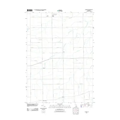
2011 Map of Chapin
USGS Topo · Published 2011About this map
Marion Springs serves as a primary reference point in this corner of Saginaw County, where a grid of rural roads connects several small settlements and community landmarks. This landscape is defined by its drainages, with the South Fork Bad River and its tributaries, including Limbocker Creek and Lamb Creek, winding through the agricultural terrain. Genealogists and local historians will find significant detail in the cluster of cemeteries near the northern border, specifically Saint Theresa Cemetery, Marion Township Cemetery, and Saint Johns Cemetery. To the south, the map documents the quiet locales of Racy, Fenmore, and Chapin, illustrating the persistent rural settlement patterns of the early 21st century. The map also records localized intersections such as Olney Corners, anchoring the southern boundary along W Ridge Rd.
Find a feature on this map
43 named features on this map. Tap any name to fly to it.
Don’t see what you’re looking for? This feature index may not catch every label — zoom into the map to look around manually.
Map Details
Editions of this 2011 Chapin Map
This is the sole edition of this map. No revisions or reprints were ever made.
Other maps of this area

1917 · Chesaning
USGS Topo · 1:62,500

1917 · St. Charles
USGS Topo · 1:62,500

1918 · Elsie
USGS Topo · 1:62,500

1934 · Merrill
USGS Topo · 1:62,500

1937 · Merrill
USGS Topo · 1:62,500

1943 · Chesaning
USGS Topo · 1:62,500

1943 · St. Charles
USGS Topo · 1:62,500

1943 · Elsie
USGS Topo · 1:62,500

1954 · Midland
USGS Topo · 1:250,000

1958 · Midland
USGS Topo · 1:250,000