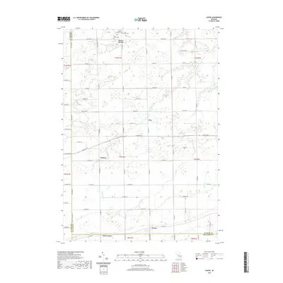
2019 Map of Chapin
USGS Topo · Published 2019About this map
Marion Springs serves as a northern anchor for this rural landscape, situated near several local landmarks including the Marion Township Cem and the Saint Johns Cem. The region is defined by a complex network of agricultural drainage and small waterways, where the South Fork Bad River and Little Potato Cr move across the flat terrain. Small intersections like Fenmore, Racy, and Olney Corners mark the centers of local activity, often situated at the crossings of major section roads. In the south, the settlement of Chapin sits just north of the county line, surrounded by the headwaters of Lamb Cr and Coon Drain. This map reveals a late-period view of Michigan's farming heartland, where the original township grid and family-centered burial grounds like Saint Theresa Cem remain the primary points of orientation.
Find a feature on this map
66 named features on this map. Tap any name to fly to it.
Don’t see what you’re looking for? This feature index may not catch every label — zoom into the map to look around manually.
Map Details
Editions of this 2019 Chapin Map
This is the sole edition of this map. No revisions or reprints were ever made.
Other maps of this area

1917 · Chesaning
USGS Topo · 1:62,500

1917 · St. Charles
USGS Topo · 1:62,500

1918 · Elsie
USGS Topo · 1:62,500

1934 · Merrill
USGS Topo · 1:62,500

1937 · Merrill
USGS Topo · 1:62,500

1943 · Chesaning
USGS Topo · 1:62,500

1943 · St. Charles
USGS Topo · 1:62,500

1943 · Elsie
USGS Topo · 1:62,500

1954 · Midland
USGS Topo · 1:250,000

1958 · Midland
USGS Topo · 1:250,000