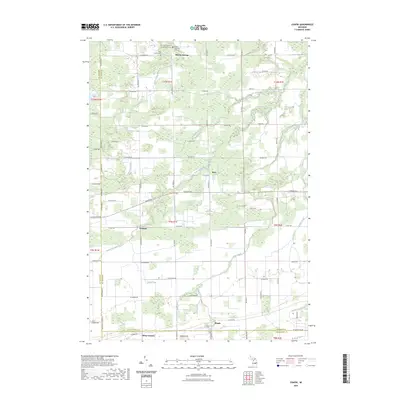
2023 Map of Chapin
USGS Topo · Published 2023About this map
Marion Springs serves as a primary reference point in this agricultural landscape at the northern edge of the Saginaw and Gratiot county line. The region is defined by a sophisticated network of water management, where natural features like the South Fork Bad River and Limbacker Creek are augmented by human-engineered systems such as Olney Drain and Coon Drain. These waterways navigate a terrain organized by a rigid grid of country roads, including W Marion Rd and S Meridian Rd.
Find a feature on this map
64 named features on this map. Tap any name to fly to it.
Don’t see what you’re looking for? This feature index may not catch every label — zoom into the map to look around manually.
Map Details
Editions of this 2023 Chapin Map
This is the sole edition of this map. No revisions or reprints were ever made.
Other maps of this area

1917 · Chesaning
USGS Topo · 1:62,500

1917 · St. Charles
USGS Topo · 1:62,500

1918 · Elsie
USGS Topo · 1:62,500

1934 · Merrill
USGS Topo · 1:62,500

1937 · Merrill
USGS Topo · 1:62,500

1943 · Chesaning
USGS Topo · 1:62,500

1943 · St. Charles
USGS Topo · 1:62,500

1943 · Elsie
USGS Topo · 1:62,500

1954 · Midland
USGS Topo · 1:250,000

1958 · Midland
USGS Topo · 1:250,000