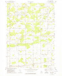
1974 Map of Chapin
USGS Topo · Published 1978About this map
The Gratiot-Saginaw State Game Management Area occupies the northern reaches of this mid-1970s survey, marking a distinct transition from managed wildlife territory to the structured grid of Michigan's agricultural heartland. Small crossroads settlements such as Marion Springs and Chapin serve as local anchors, connected by a network of section-line roads like Meridian Road and Marion Road. The landscape is defined by its drainages, where the South Fork Bad River and Potato Creek wind through fields dotted with numerous Sandpit and Gravel Pit operations, reflecting the local importance of aggregate mining. Genealogical interest is concentrated in several local burying grounds, including St Johns Cem, St Theresa Cem, and the Township Cem, alongside old landmarks like Johns Sch and the community at Racy.
Find a feature on this map
57 named features on this map. Tap any name to fly to it.
Don’t see what you’re looking for? This feature index may not catch every label — zoom into the map to look around manually.
Map Details
Editions of this 1974 Chapin Map
This is the sole edition of this map. No revisions or reprints were ever made.
Other maps of this area

1917 · Chesaning
USGS Topo · 1:62,500

1917 · St. Charles
USGS Topo · 1:62,500

1918 · Elsie
USGS Topo · 1:62,500

1934 · Merrill
USGS Topo · 1:62,500

1937 · Merrill
USGS Topo · 1:62,500

1943 · Chesaning
USGS Topo · 1:62,500

1943 · St. Charles
USGS Topo · 1:62,500

1943 · Elsie
USGS Topo · 1:62,500

1954 · Midland
USGS Topo · 1:250,000

1958 · Midland
USGS Topo · 1:250,000