
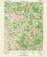
1952 Map of Chaplin
USGS Topo · Published 1953About this map
The Salt River and Chaplin River dominate this Central Kentucky landscape, their winding courses carving through the borderlands where Spencer, Nelson, Anderson, and Washington Counties meet. In the early 1950s, the settlement of Chaplin serves as a local hub, while smaller communities like Van Buren and Sparrow are connected by a network of rural roads and bridges, including the Goodnight Bridge. The topography is defined by prominent ridges and hills, most notably Grave Ridge and Driscol Hill.
Find a feature on this map
36 named features on this map. Tap any name to fly to it.
Don’t see what you’re looking for? This feature index may not catch every label — zoom into the map to look around manually.
Map Details
Editions of this 1952 Chaplin Map
2 editions found
Other maps of this area

1923 · Waddy
USGS Topo · 1:48,000

1925 · Mount Eden
USGS Topo · 1:48,000

1927 · Mount Eden
USGS Topo · 1:62,500

1929 · Taylorsville
USGS Topo · 1:62,500

1952 · Ashbrook
USGS Topo · 1:24,000

1953 · Brush Grove
USGS Topo · 1:24,000

1953 · Maud
USGS Topo · 1:24,000

1953 · Cardwell
USGS Topo · 1:24,000

1953 · Bloomfield
USGS Topo · 1:24,000
1954 · Glensboro
USGS Topo · 1:24,000