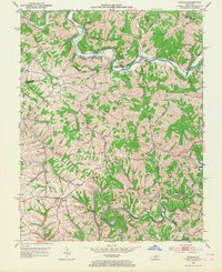
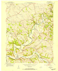
1952 Map of Chaplin
USGS Topo · Published 1968About this map
The Salt River and Chaplin River snake through this landscape, defining the boundaries where Spencer, Nelson, Anderson, and Washington counties meet. In the early 1950s, the rural character of the region was centered around small crossroads and river landings like Van Buren and Mitchell. The rugged topography is dominated by Pleasant Grove Ridge and the winding course of Ashleys Creek and Beaver Creek. Local social life is evidenced by several rural congregations and landmarks, including Highview Ch, Green Chapel, and the Highview Cem. Infrastructure of the era is preserved in details like the Goodnight Bridge crossing the Salt River and the numerous fords, such as Gordon Ford, which provided vital river crossings before more modern developments altered the regional travel patterns.
Find a feature on this map
34 named features on this map. Tap any name to fly to it.
Don’t see what you’re looking for? This feature index may not catch every label — zoom into the map to look around manually.
Map Details
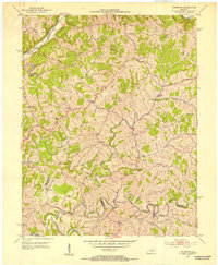
Editions of this 1952 Chaplin Map
2 editions found
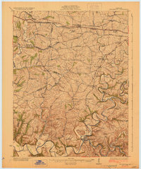
Other maps of this area

1923 · Waddy
USGS Topo · 1:48,000

1925 · Mount Eden
USGS Topo · 1:48,000

1927 · Mount Eden
USGS Topo · 1:62,500
1929 · Taylorsville
USGS Topo · 1:62,500
1952 · Ashbrook
USGS Topo · 1:24,000
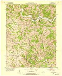
1952 · Chaplin
USGS Topo · 1:24,000

1953 · Brush Grove
USGS Topo · 1:24,000
1953 · Maud
USGS Topo · 1:24,000
1953 · Cardwell
USGS Topo · 1:24,000
1953 · Bloomfield
USGS Topo · 1:24,000