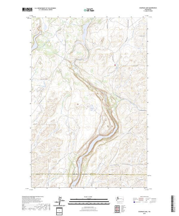
2023 Map of Chapman Lake
USGS Topo · Published 2023About this map
Rock Creek carves a significant path through this portion of the Channeled Scablands, defining the drainage patterns and topography of the border between Spokane and Whitman counties. This contemporary survey illustrates the complex relationship between the water-rich depressions of Johnson Lake and the dry, basalt-etched plateaus that characterize the region. The landscape is interconnected by a network of long-established country roads such as W Chapman Lake Rd and S Cheney Plaza Rd, which navigate the coulees and scabland formations. Many of these routes, including S Texas Ferry Rd, follow historical corridors that have served the agricultural and transit needs of the Palouse and surrounding prairies for generations. The presence of smaller tributaries like Sanders Creek and Huckeye Creek underscores the intricate hydrology that remains central to this rural Washington environment.
Find a feature on this map
30 named features on this map. Tap any name to fly to it.
Don’t see what you’re looking for? This feature index may not catch every label — zoom into the map to look around manually.
Map Details
Editions of this 2023 Chapman Lake Map
This is the sole edition of this map. No revisions or reprints were ever made.
Other maps of this area

1903 · Oakesdale
USGS Topo · 1:125,000

1905 · Oakesdale
USGS Topo · 1:125,000

1954 · Cheney
USGS Topo · 1:62,500

1954 · Spangle
USGS Topo · 1:62,500

1955 · Spokane
USGS Topo · 1:250,000

1958 · Spokane
USGS Topo · 1:250,000

1964 · Malden
USGS Topo · 1:24,000

1964 · Rock Lake
USGS Topo · 1:24,000

1964 · Pine City
USGS Topo · 1:24,000
1980 · Spangle West
USGS Topo · 1:24,000