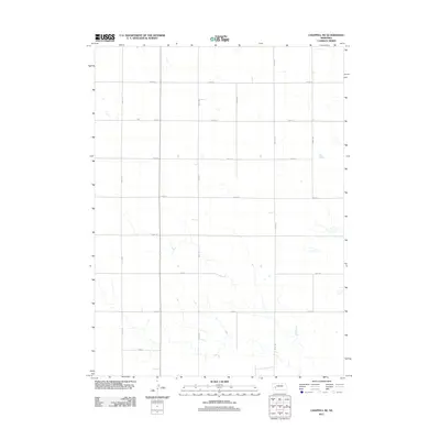
2011 Map of Chappell NE
USGS Topo · Published 2011About this map
The agricultural grid of Deuel County defines the landscape north of Chappell, Nebraska, in this 2011 survey. A rigorous network of rural thoroughfares, including north-south routes like Road 177 and Road 187, provides access to the vast sections of farmland that dominate the High Plains terrain here. Intersecting these are primary east-west corridors such as Road 34 and Road 20, which facilitate movement across the open prairie. This map illustrates the precision of the Public Land Survey System, showing how modern transportation routes adhere strictly to section lines, reflecting the organized settlement and land management patterns of the early twenty-first century in the Nebraska Panhandle.
Find a feature on this map
13 named features on this map. Tap any name to fly to it.
Don’t see what you’re looking for? This feature index may not catch every label — zoom into the map to look around manually.
Map Details
Editions of this 2011 Chappell NE Map
This is the sole edition of this map. No revisions or reprints were ever made.
Other maps of this area

1900 · Chappell
USGS Topo · 1:125,000

1954 · Scottsbluff
USGS Topo · 1:250,000

1958 · Scottsbluff
USGS Topo · 1:250,000

1961 · Chappell
USGS Topo · 1:24,000

1961 · Barton
USGS Topo · 1:24,000

1961 · Chappell SE
USGS Topo · 1:24,000

1971 · Barn Butte
USGS Topo · 1:24,000

1971 · Chappell NE
USGS Topo · 1:24,000

1971 · Oshkosh SW
USGS Topo · 1:24,000
1971 · Lewellen
USGS Topo · 1:24,000