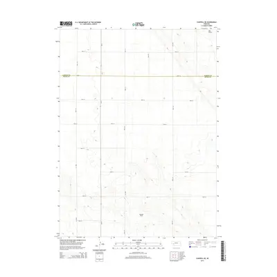
2014 Map of Chappell NE
USGS Topo · Published 2014About this map
The rolling tablelands of the Nebraska panhandle are captured here, centered on the boundary between Garden Co and Deuel Co. This High Plains landscape is defined by its dramatic topographic shifts, particularly where the plateau breaks into drainage features like Ash Hollow in the northeast and the meandering Walrath Draw in the south. The area is dominated by a grid of rural corridors, including Road 177 and Road 185, which facilitate movement through this agricultural and ranching territory. A primary north-south artery is marked as Ne-27, providing a modern connection across the county line. The map illustrates how human settlement and infrastructure in this part of Nebraska are deeply tied to the natural contours and the seasonal watercourses that have shaped the land for generations.
Find a feature on this map
16 named features on this map. Tap any name to fly to it.
Don’t see what you’re looking for? This feature index may not catch every label — zoom into the map to look around manually.
Map Details
Editions of this 2014 Chappell NE Map
This is the sole edition of this map. No revisions or reprints were ever made.
Other maps of this area

1900 · Chappell
USGS Topo · 1:125,000

1954 · Scottsbluff
USGS Topo · 1:250,000

1958 · Scottsbluff
USGS Topo · 1:250,000

1961 · Chappell
USGS Topo · 1:24,000

1961 · Barton
USGS Topo · 1:24,000

1961 · Chappell SE
USGS Topo · 1:24,000

1971 · Barn Butte
USGS Topo · 1:24,000

1971 · Chappell NE
USGS Topo · 1:24,000

1971 · Oshkosh SW
USGS Topo · 1:24,000
1971 · Lewellen
USGS Topo · 1:24,000