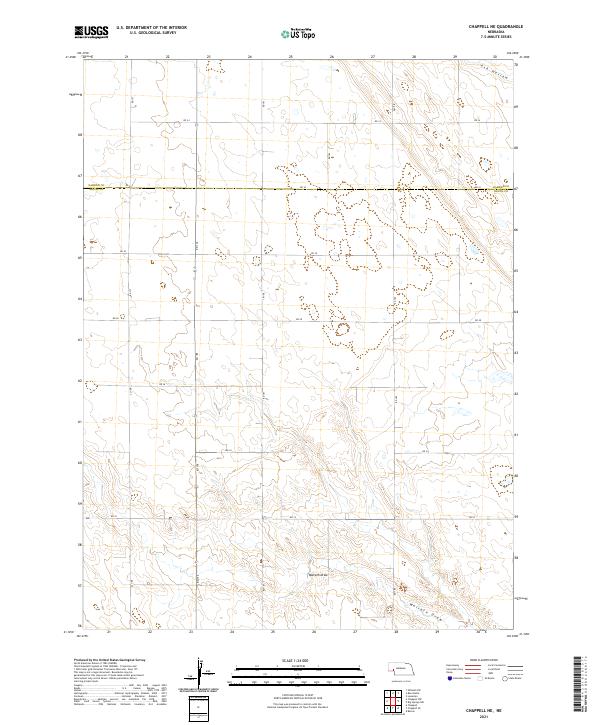
2021 Map of Chappell NE
USGS Topo · Published 2021About this map
Walrath Draw meanders through the southern portion of this landscape, carving a distinctive drainage pattern across the high plains of the Nebraska Panhandle. Located along the border where Garden Co meets Deuel Co, the terrain is defined by a strictly organized section line road network, including north-south routes like Rd 179 and Rd 181. The northern edge of the sheet is marked by the presence of Ash Hollow, a significant topographic feature historically vital to travelers in this region. This modern survey reflects the enduring structure of the Public Land Survey System, showing township and range divisions such as t15n r43w that have dictated land ownership and agricultural patterns for generations.
Find a feature on this map
21 named features on this map. Tap any name to fly to it.
Don’t see what you’re looking for? This feature index may not catch every label — zoom into the map to look around manually.
Map Details
Editions of this 2021 Chappell NE Map
This is the sole edition of this map. No revisions or reprints were ever made.
Other maps of this area

1900 · Chappell
USGS Topo · 1:125,000

1954 · Scottsbluff
USGS Topo · 1:250,000

1958 · Scottsbluff
USGS Topo · 1:250,000

1961 · Chappell
USGS Topo · 1:24,000

1961 · Barton
USGS Topo · 1:24,000

1961 · Chappell SE
USGS Topo · 1:24,000

1971 · Barn Butte
USGS Topo · 1:24,000

1971 · Chappell NE
USGS Topo · 1:24,000

1971 · Oshkosh SW
USGS Topo · 1:24,000
1971 · Lewellen
USGS Topo · 1:24,000