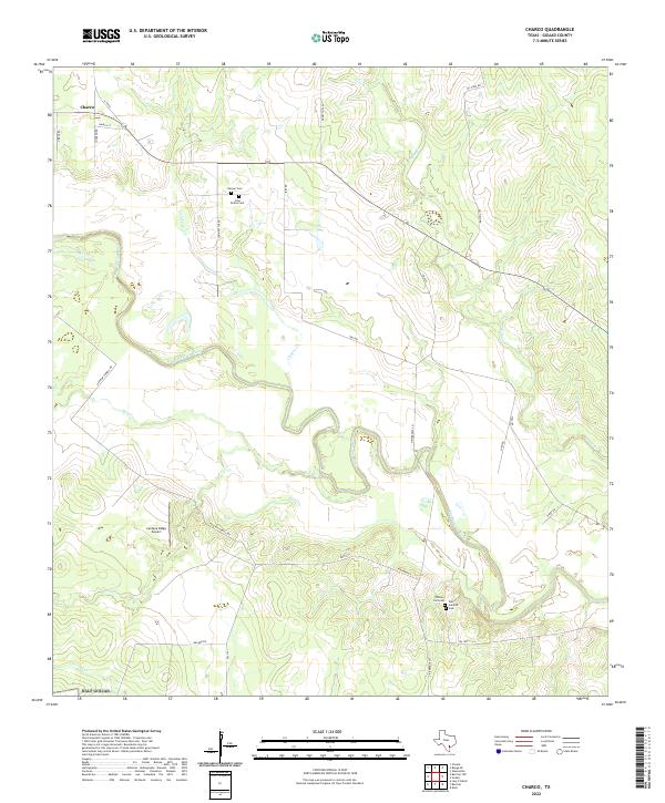
2022 Map of Charco
USGS Topo · Published 2022About this map
The San Antonio River carves a winding path through this portion of Goliad County, defining a landscape of riparian corridors and tributary drainages. The small community of Charco sits in the northwest, serving as a focal point for a network of local routes like FM 81 and Johnson Rd. This area is characterized by its agricultural and ranching layout, with large tracts of land divided by roads such as Irby Rd and Oil Field Rd.
Find a feature on this map
29 named features on this map. Tap any name to fly to it.
Don’t see what you’re looking for? This feature index may not catch every label — zoom into the map to look around manually.
Map Details
Editions of this 2022 Charco Map
This is the sole edition of this map. No revisions or reprints were ever made.
Other maps of this area

1953 · Beeville
USGS Topo · 1:250,000

1956 · Beeville
USGS Topo · 1:250,000

1960 · Beeville
USGS Topo · 1:250,000

1962 · Melo
USGS Topo · 1:24,000

1962 · Goliad
USGS Topo · 1:24,000
1963 · Choate
USGS Topo · 1:24,000

1963 · Lazy F Ranch
USGS Topo · 1:24,000

1963 · Weesatche
USGS Topo · 1:24,000
1963 · Berclair NW
USGS Topo · 1:24,000

1963 · Berclair
USGS Topo · 1:24,000