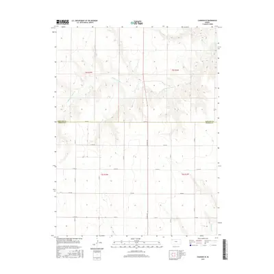
2015 Map of Chardon SE
USGS Topo · Published 2015About this map
The High Plains landscape of northwest Kansas is defined by the ephemeral flow of the Middle Fork Sappa Cr, which winds through the northern half of this territory before meeting the S Fork Sappa Cr in the southeast corner. This 2015 survey illustrates a rural environment shaped by the Public Land Survey System, with a rigid grid of section lines and county roads such as Co Rd Ee and Co Rd Aa providing the primary structure for movement across the plains.
Find a feature on this map
19 named features on this map. Tap any name to fly to it.
Don’t see what you’re looking for? This feature index may not catch every label — zoom into the map to look around manually.
Map Details
Editions of this 2015 Chardon SE Map
This is the sole edition of this map. No revisions or reprints were ever made.
Other maps of this area
1943 · Colby
USGS Topo · 1:62,500
1951 · Achilles
USGS Topo · 1:62,500
1951 · Chardon
USGS Topo · 1:62,500

1954 · Goodland
USGS Topo · 1:250,000

1956 · Goodland
USGS Topo · 1:250,000

1957 · Goodland
USGS Topo · 1:250,000
1967 · Levant
USGS Topo · 1:24,000
1967 · Colby
USGS Topo · 1:24,000
1978 · Long Draw South
USGS Topo · 1:24,000
1978 · Chardon
USGS Topo · 1:24,000