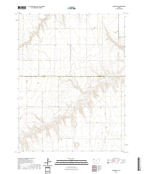
2022 Map of Chardon SW
USGS Topo · Published 2022About this map
Ilion Cem sits on the high plains near the northern boundary of Thomas County, marking a quiet point of local genealogy in this agricultural landscape. The terrain is defined by the winding drainages of the N Fork Sappa Cr and the more prominent Middle Fork Sappa Cr, which carves through the southern half of the quadrangle. This 2022 survey illustrates the grid of county roads, such as Co RD Ee and Co RD Aa, that partition the land between Rawlins and Thomas counties. The map captures the persistence of the section line system and the subtle topography of the Sappa Creek forks as they have shaped development and drainage in this corner of the High Plains for generations.
Find a feature on this map
26 named features on this map. Tap any name to fly to it.
Don’t see what you’re looking for? This feature index may not catch every label — zoom into the map to look around manually.
Map Details
Editions of this 2022 Chardon SW Map
This is the sole edition of this map. No revisions or reprints were ever made.
Other maps of this area

1943 · Colby
USGS Topo · 1:62,500

1951 · Chardon
USGS Topo · 1:62,500

1951 · Dewey Ranch
USGS Topo · 1:62,500

1954 · Goodland
USGS Topo · 1:250,000

1956 · Goodland
USGS Topo · 1:250,000

1957 · Goodland
USGS Topo · 1:250,000

1967 · Brewster NE
USGS Topo · 1:24,000

1967 · Levant
USGS Topo · 1:24,000

1967 · Colby
USGS Topo · 1:24,000
1978 · Chardon
USGS Topo · 1:24,000