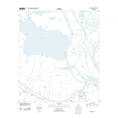
2012 Map of Charenton
USGS Topo · Published 2012About this map
Charenton and the surrounding sugar country of St. Mary Parish are defined by the winding course of Bayou Teche and an extensive network of drainage and navigation infrastructure. This 2012 survey illustrates the complex relationship between the natural landscape and human engineering, featuring the Charenton Drainage and Navigation Canal and the massive W Atchafalaya Basin Spillway that protects the region from seasonal floodwaters.
Find a feature on this map
49 named features on this map. Tap any name to fly to it.
Don’t see what you’re looking for? This feature index may not catch every label — zoom into the map to look around manually.
Map Details
Editions of this 2012 Charenton Map
This is the sole edition of this map. No revisions or reprints were ever made.
Other maps of this area

1935 · Chicot Lake
USGS Topo · 1:62,500

1937 · Jeanerette
USGS Topo · 1:62,500

1941 · Loreauville
USGS Topo · 1:62,500

1945 · New Orleans
USGS Topo · 1:250,000

1948 · Foster
USGS Topo · 1:62,500

1954 · Chicot Lake
USGS Topo · 1:62,500

1954 · Loreauville
USGS Topo · 1:62,500

1954 · Jeanerette
USGS Topo · 1:62,500

1954 · Baton Rouge
USGS Topo · 1:250,000
1955 · Chicot Lake
USGS Topo · 1:62,500