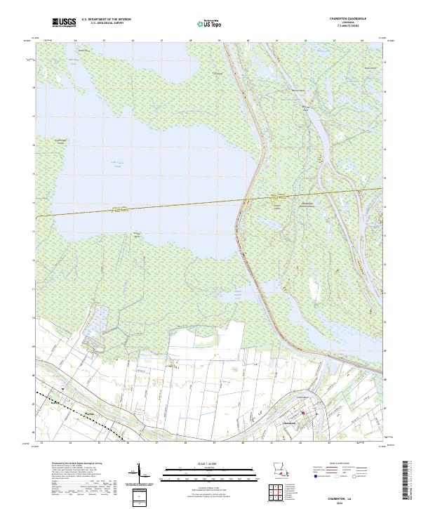
2024 Map of Charenton
USGS Topo · Published 2024About this map
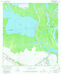
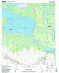
Charenton and the surrounding sugar country of St. Mary Parish sit at the intersection of traditional Cajun waterways and modern industrial infrastructure. The landscape is defined by the winding course of Bayou Teche, which flows past the settlements of Sorrel and Matilda. This area reflects the deep cultural roots of the region, evidenced by roads like Chitimacha Trl, while the massive Atchafalaya Basin Floodway and the W Atchafalaya Basin Spillway Levee dominate the eastern portion of the map, protecting the lowlands from the seasonal waters of the basin.
Find a feature on this map
58 named features on this map. Tap any name to fly to it.
Don’t see what you’re looking for? This feature index may not catch every label — zoom into the map to look around manually.
Map Details
Editions of this 2024 Charenton Map
This is the sole edition of this map. No revisions or reprints were ever made.
Historical Maps of Matilda Through Time
3 maps found