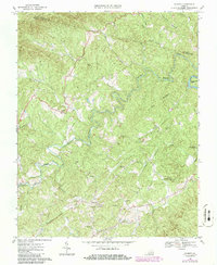
1967 Map of Charity
USGS Topo · Published 1986About this map
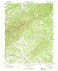
The Smith River carves a winding path through this corner of Patrick County, serving as the central geographic anchor for rural communities like Charity and Elamsville. By the mid-1960s, the landscape reflected a deeply established network of local landmarks, including the Fairview (Goodwill Ch) and Goblintown Ch. The presence of the Covered Bridge Smith River Ch suggests a history of river crossings that predated modern infrastructure, while the Old Ironbelt label points toward the region's earlier industrial or transport heritage.
Find a feature on this map
28 named features on this map. Tap any name to fly to it.
Don’t see what you’re looking for? This feature index may not catch every label — zoom into the map to look around manually.
Map Details
Editions of this 1967 Charity Map
2 editions found
Other maps of this area

1926 · Critz
USGS Topo · 1:48,000

1928 · Stuart
USGS Topo · 1:48,000

1928 · Critz
USGS Topo · 1:62,500

1931 · Stuart
USGS Topo · 1:62,500

1953 · Winston-Salem
USGS Topo · 1:250,000

1955 · Winston-Salem
USGS Topo · 1:250,000
1957 · Endicott
USGS Topo · 1:62,500
1957 · Floyd
USGS Topo · 1:62,500

1962 · Winston-Salem
USGS Topo · 1:250,000
1967 · Patrick Springs
USGS Topo · 1:24,000