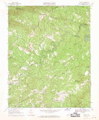
1967 Map of Charity
USGS Topo · Published 1970About this map
The Smith River and its intricate network of tributaries define this pocket of the Blue Ridge foothills during the mid-1960s. Local life centers on small settlements and numerous rural congregations, including the uniquely named Covered Bridge Smith River Ch and Old Ironbelt Ch. The map captures the rugged transition between the highlands and the developing Philpott Reservoir, where the Blue Ridge Pkwy skirts the northern edge of the terrain.
Find a feature on this map
34 named features on this map. Tap any name to fly to it.
Don’t see what you’re looking for? This feature index may not catch every label — zoom into the map to look around manually.
Map Details
Editions of this 1967 Charity Map
2 editions found
Other maps of this area

1926 · Critz
USGS Topo · 1:48,000

1928 · Stuart
USGS Topo · 1:48,000

1928 · Critz
USGS Topo · 1:62,500

1931 · Stuart
USGS Topo · 1:62,500

1953 · Winston-Salem
USGS Topo · 1:250,000

1955 · Winston-Salem
USGS Topo · 1:250,000

1957 · Endicott
USGS Topo · 1:62,500

1957 · Floyd
USGS Topo · 1:62,500

1962 · Winston-Salem
USGS Topo · 1:250,000

1967 · Patrick Springs
USGS Topo · 1:24,000