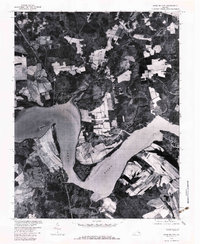
1979 Map of Charles City
USGS Topo · Published 1983About this map
The James River dominates this 1979 orthophotoquad, defining the geography of a historic Tidewater region. On the northern banks, Charles City and Ruthville are set against a landscape of agricultural fields and woodland. The aerial imagery captures the distinct rural patterns of the late 1970s, where small settlements like Bowens Store and Milton sit at the intersections of local roads and farming plots.
Find a feature on this map
9 named features on this map. Tap any name to fly to it.
Don’t see what you’re looking for? This feature index may not catch every label — zoom into the map to look around manually.
Map Details
Editions of this 1979 Charles City Map
This is the sole edition of this map. No revisions or reprints were ever made.
Other maps of this area

1917 · Toano
USGS Topo · 1:62,500

1918 · Charles City
USGS Topo · 1:62,500

1918 · Toano
USGS Topo · 1:62,500

1919 · Surry
USGS Topo · 1:62,500

1919 · Disputanta
USGS Topo · 1:62,500

1943 · Savedge
USGS Topo · 1:31,680

1943 · Disputanta
USGS Topo · 1:31,680

1943 · Richmond
USGS Topo · 1:250,000

1949 · Richmond
USGS Topo · 1:250,000
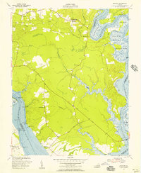
1952 · Brandon
USGS Topo · 1:24,000