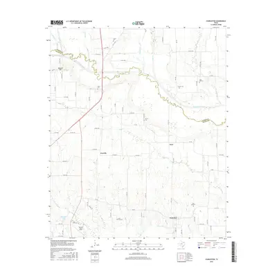
2016 Map of Charleston
USGS Topo · Published 2016About this map
The North Sulphur River snakes across the boundary of Lamar and Delta Counties, anchoring a landscape defined by small rural settlements and numerous family and community burial grounds. This 2016 survey shows the enduring footprint of historic hamlets like Charleston and Prattville, which remain connected by a network of Farm to Market roads and county routes. The area's genealogical depth is visible in the density of local cemeteries, including Slabtown Cem, Union Grove Cem, and Hazel Dell Cem, often situated near small watercourses such as Auds Cr and Post Oak Cr. Modern aviation and recreation also appear through the Oak Glen Ranch Airport and the Delta Country Club Lake. The map illustrates a contemporary view of the Texas Blackland Prairies region, where agricultural patterns follow the contours of drainages like Greenbrier Br and Evans Br.
Find a feature on this map
82 named features on this map. Tap any name to fly to it.
Don’t see what you’re looking for? This feature index may not catch every label — zoom into the map to look around manually.
Map Details
Editions of this 2016 Charleston Map
This is the sole edition of this map. No revisions or reprints were ever made.
Other maps of this area

1903 · Paris
USGS Topo · 1:125,000

1948 · Paris
USGS Topo · 1:62,500

1949 · Paris
USGS Topo · 1:62,500

1953 · Texarkana
USGS Topo · 1:250,000

1956 · Texarkana
USGS Topo · 1:250,000

1962 · Sulphur Bluff
USGS Topo · 1:24,000

1963 · Minter
USGS Topo · 1:24,000

1964 · Pattonville
USGS Topo · 1:24,000

1964 · Charleston
USGS Topo · 1:24,000

1964 · Tira
USGS Topo · 1:24,000