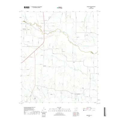
2019 Map of Charleston
USGS Topo · Published 2019About this map
The North Sulphur River carves a sinuous path through this rural landscape along the border of Lamar and Delta Counties. The settlement pattern here is defined by small, dispersed communities including Charleston, Mount Joy, Prattville, and Pacio, which are connected by a network of farm-to-market roads and county lanes. The high density of local cemeteries, such as Slabtown Cem, Union Grove Cem, and Hazel Dell Cem, points to the deep generational ties within these North Texas farming communities. To the south, the terrain is segmented by numerous tributaries including McGuyer Br, Evans Br, and Greenbrier Br, while the Oak Glen Ranch Airport provides a modern navigational landmark amidst the traditional agricultural holdings. This survey captures the region just as it maintains its quiet, agrarian character in the late 2010s.
Find a feature on this map
76 named features on this map. Tap any name to fly to it.
Don’t see what you’re looking for? This feature index may not catch every label — zoom into the map to look around manually.
Map Details
Editions of this 2019 Charleston Map
This is the sole edition of this map. No revisions or reprints were ever made.
Other maps of this area

1903 · Paris
USGS Topo · 1:125,000

1948 · Paris
USGS Topo · 1:62,500

1949 · Paris
USGS Topo · 1:62,500

1953 · Texarkana
USGS Topo · 1:250,000

1956 · Texarkana
USGS Topo · 1:250,000

1962 · Sulphur Bluff
USGS Topo · 1:24,000

1963 · Minter
USGS Topo · 1:24,000

1964 · Pattonville
USGS Topo · 1:24,000

1964 · Charleston
USGS Topo · 1:24,000

1964 · Tira
USGS Topo · 1:24,000