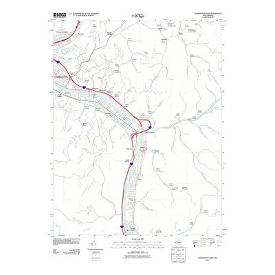
2011 Map of Charleston East
USGS Topo · Published 2011About this map
Charleston and its surrounding communities along the Kanawha River define this 2011 survey, showing the complex intersection of industry, transportation, and topography. The landscape is characterized by the many hollows that branch off the river valley, such as Ruffner Hollow, Harris Hollow, and Blackhawk Hollow, which have historically dictated the patterns of local development. Notable landmarks including Yeager Airport and the University of Charleston occupy prominent positions, while the river itself is regulated by structures like the Atkisson Dam Lighthouse.
Find a feature on this map
129 named features on this map. Tap any name to fly to it.
Don’t see what you’re looking for? This feature index may not catch every label — zoom into the map to look around manually.
Map Details
Editions of this 2011 Charleston East Map
This is the sole edition of this map. No revisions or reprints were ever made.
Other maps of this area

1897 · Kanawha Falls
USGS Topo · 1:125,000

1899 · Charleston
USGS Topo · 1:125,000

1900 · Kanawha Falls
USGS Topo · 1:125,000

1901 · Kanawha Falls
USGS Topo · 1:125,000

1907 · Clendenin
USGS Topo · 1:62,500

1908 · Montgomery
USGS Topo · 1:48,000

1909 · Charleston
USGS Topo · 1:62,500

1909 · Clendenin
USGS Topo · 1:62,500

1909 · Peytona
USGS Topo · 1:48,000

1910 · Montgomery
USGS Topo · 1:62,500