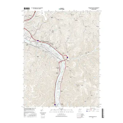
2016 Map of Charleston East
USGS Topo · Published 2016About this map
The Kanawha River serves as the central artery for this industrial and residential corridor, carving a path through the valley between Snow Hill and Malden Mtn. Along its banks, the capital city's expansion is evident in neighborhoods like Kanawha City and South Ruffner, connected to the north bank by the Kanawha City Bridge and the 35th Street Bridge. The map captures a landscape where mid-century infrastructure, such as Yeager Airport, overlays a much older pattern of family settlements and hollows. Numerous small cemeteries, including Hess Cem and the Hunt-Donnally Cem, are tucked into the steep drainages of Crouch Hollow and Blackhawk Hollow, providing vital markers for local genealogical research. Further downriver, the industrial character of the valley intensifies near Port Amherst and the Dupont Waste Lake, reflecting the region's long-standing reliance on the river for transport and industry.
Find a feature on this map
130 named features on this map. Tap any name to fly to it.
Don’t see what you’re looking for? This feature index may not catch every label — zoom into the map to look around manually.
Map Details
Editions of this 2016 Charleston East Map
This is the sole edition of this map. No revisions or reprints were ever made.
Other maps of this area

1897 · Kanawha Falls
USGS Topo · 1:125,000

1899 · Charleston
USGS Topo · 1:125,000

1900 · Kanawha Falls
USGS Topo · 1:125,000

1901 · Kanawha Falls
USGS Topo · 1:125,000

1907 · Clendenin
USGS Topo · 1:62,500

1908 · Montgomery
USGS Topo · 1:48,000

1909 · Charleston
USGS Topo · 1:62,500

1909 · Clendenin
USGS Topo · 1:62,500

1909 · Peytona
USGS Topo · 1:48,000

1910 · Montgomery
USGS Topo · 1:62,500