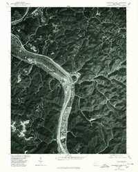
1977 Map of Charleston East
USGS Topo · Published 1980About this map
The Kanawha River corridor serves as the industrial and residential backbone of this West Virginia landscape, as seen in this 1977 orthophotograph. Dense development follows the river valley from Charleston through Kanawha City, where the narrow flatlands between steep hills have dictated the expansion of the regional infrastructure. This aerial perspective, prepared in cooperation with the Soil Conservation Service, reveals the sharp contrast between the heavily populated riverfront and the deep, wooded ravines that isolate settlements like Coal Fork and Port Amherst.
Find a feature on this map
9 named features on this map. Tap any name to fly to it.
Don’t see what you’re looking for? This feature index may not catch every label — zoom into the map to look around manually.
Map Details
Editions of this 1977 Charleston East Map
This is the sole edition of this map. No revisions or reprints were ever made.
Other maps of this area

1897 · Kanawha Falls
USGS Topo · 1:125,000

1899 · Charleston
USGS Topo · 1:125,000

1900 · Kanawha Falls
USGS Topo · 1:125,000

1901 · Kanawha Falls
USGS Topo · 1:125,000

1907 · Clendenin
USGS Topo · 1:62,500

1908 · Montgomery
USGS Topo · 1:48,000

1909 · Charleston
USGS Topo · 1:62,500

1909 · Clendenin
USGS Topo · 1:62,500

1909 · Peytona
USGS Topo · 1:48,000

1910 · Montgomery
USGS Topo · 1:62,500