
1957 Map of Charleston Peak
USGS Topo · Published 1959About this map
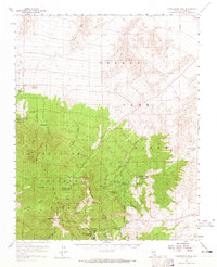
Toiyabe National Forest dominates this high-altitude landscape, centered on the dramatic elevation of Charleston Peak. The map reveals a mid-century recreational and administrative network within the mountains, featuring the Kyle Ranger Sta and Lee Guard Sta, alongside various sites like Camp Bonanza (BSA) and the Air Force Rest Camp. On the eastern slopes, the presence of an Air Force Station at Angel Peak reflects the era’s strategic military interests in the Nevada desert.
Find a feature on this map
54 named features on this map. Tap any name to fly to it.
Don’t see what you’re looking for? This feature index may not catch every label — zoom into the map to look around manually.
Map Details
Editions of this 1957 Charleston Peak Map
2 editions found
Other maps of this area

1907 · Las Vegas
USGS Topo · 1:250,000

1908 · Las Vegas
USGS Topo · 1:250,000

1942 · Indian Spring
USGS Topo · 1:125,000

1945 · Sheep Range
USGS Topo · 1:125,000

1952 · Corn Creek Springs
USGS Topo · 1:62,500

1952 · Blue Diamond
USGS Topo · 1:62,500

1952 · Mercury
USGS Topo · 1:62,500

1954 · Las Vegas
USGS Topo · 1:250,000

1957 · Las Vegas
USGS Topo · 1:250,000

1957 · Mt. Stirling
USGS Topo · 1:62,500