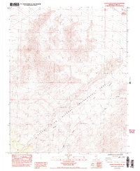
1984 Map of Charleston Peak NE
USGS Topo · Published 1984About this map
Desert View Natural Environment Area dominates the high-altitude terrain of Clark County, defined by its steep elevation changes and deep drainages. In this 1984 provisional survey, the landscape is marked by the rugged course of Lee Canyon and Deer Creek, which carve through the Spring Mountains. Human impact is sparse, indicated primarily by the presence of a Barrow Pit and the established boundaries of township and range lines. The map captures a moment in the mid-1980s when this high-desert environment remained largely focused on natural conservation and drainage patterns, with topographical contours provided at a ten-meter interval to meticulously detail the ridges and washes of the Nevada backcountry.
Find a feature on this map
6 named features on this map. Tap any name to fly to it.
Don’t see what you’re looking for? This feature index may not catch every label — zoom into the map to look around manually.
Map Details
Editions of this 1984 Charleston Peak NE Map
2 editions found
Other maps of this area

1907 · Las Vegas
USGS Topo · 1:250,000

1908 · Las Vegas
USGS Topo · 1:250,000

1942 · Indian Spring
USGS Topo · 1:125,000

1945 · Sheep Range
USGS Topo · 1:125,000

1952 · Corn Creek Springs
USGS Topo · 1:62,500

1954 · Las Vegas
USGS Topo · 1:250,000

1957 · Las Vegas
USGS Topo · 1:250,000

1957 · Charleston Peak
USGS Topo · 1:62,500

1959 · Las Vegas
USGS Topo · 1:250,000

1962 · Las Vegas
USGS Topo · 1:250,000